Floodplain Mapping
Floodplain mapping charts flood-prone areas to guide development, insurance, and risk management decisions.

September 30, 2025
What is Floodplain Mapping?
Floodplain mapping identifies areas at risk of flooding based on hydrological studies and historical data. Maps guide development decisions, insurance requirements, and emergency planning.
Why Floodplain Mapping Matters in Real Estate
Floodplain mapping matters in real estate because it impacts land use, property value, and financing. Properties in floodplains may face building restrictions, higher insurance costs, and reduced marketability.
Example of Floodplain Mapping in Action
A developer consults municipal floodplain maps before planning a new subdivision to ensure compliance with building restrictions and avoid high-risk areas.
Key Takeaways
- Identifies areas at risk of flooding.
- Used in planning, insurance, and emergency management.
- Affects property value and development potential.
- May restrict construction in high-risk zones.
- Increasingly important with climate change impacts.
Related Terms
- Environmental Assessment
- Drainage System
- Insurance
- Climate Risk
- Land Use Bylaws























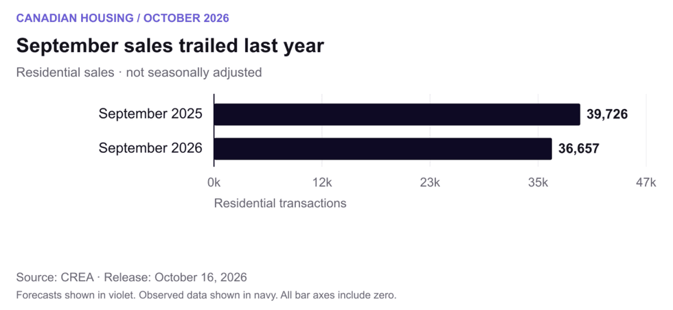 September residential sales, not seasonally adjusted; the annual comparison uses CREA’s revised figures. Chart:
 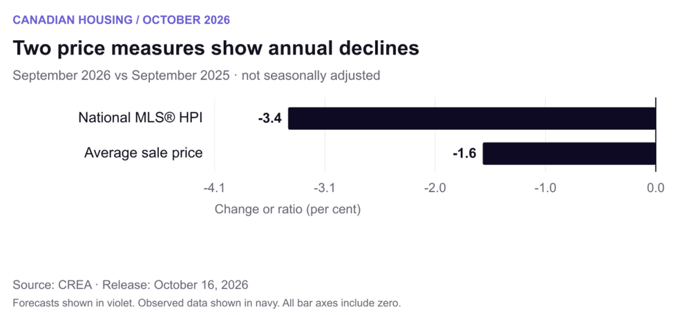 Annual changes in the unadjusted national MLS® HPI and average sale price. The average is affected by the mix of transactions. Chart:
 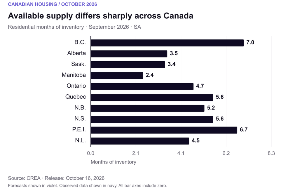 Seasonally adjusted residential months of inventory by province. Local property types can differ substantially. Chart:
 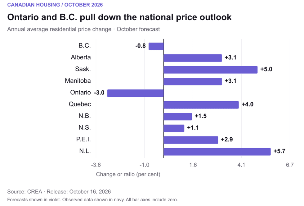 Ontario and B.C. are the two provinces with forecast annual average-price declines in 2026. Chart:
 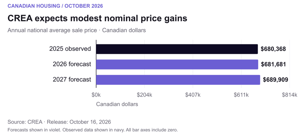 Annual average transaction prices in Canadian dollars. Forecast values are not December price targets. Chart:
 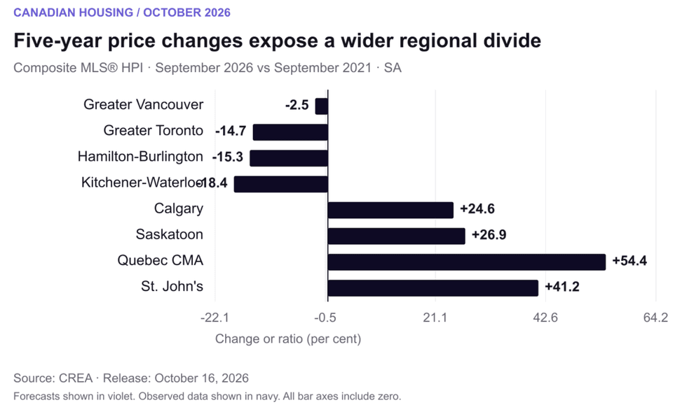 Five-year changes in seasonally adjusted composite MLS® HPI benchmarks, September 2021 to September 2026. Chart: