Final Plat
Learn about final plats in Canadian real estate — what they are, their purpose, and how they support land subdivision and sales.

August 08, 2025
What is a Final Plat?
A final plat is a detailed map of a subdivision or land development that has been approved by the local municipality, showing property boundaries, easements, and public rights-of-way.
Why Final Plats Matter in Real Estate
In Canadian real estate development, final plats are required for recording property lots and selling individual parcels.
Key points:
- Includes all lot dimensions, street names, and utility easements
- Must comply with municipal planning and zoning regulations
- Recorded with the local land registry office
Understanding final plats is crucial for developers, surveyors, and buyers of subdivided land.
Example of a Final Plat in Action
The developer submitted the final plat for municipal approval to begin selling the individual lots in the subdivision.
Key Takeaways
- Shows detailed layout of a subdivision
- Required for recording property lots
- Must meet local planning and zoning regulations
- Recorded with the land registry office
- Essential for selling individual lots
Related Terms
- Official Plan
- Subdivision Plan
- Zoning
- Survey
- Land Registry












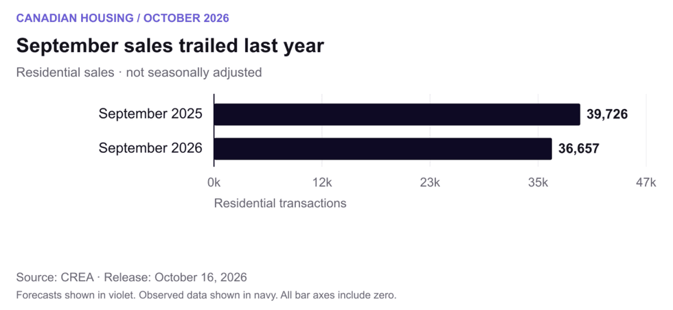 September residential sales, not seasonally adjusted; the annual comparison uses CREA’s revised figures. Chart:
 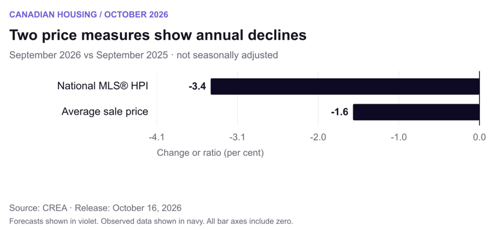 Annual changes in the unadjusted national MLS® HPI and average sale price. The average is affected by the mix of transactions. Chart:
 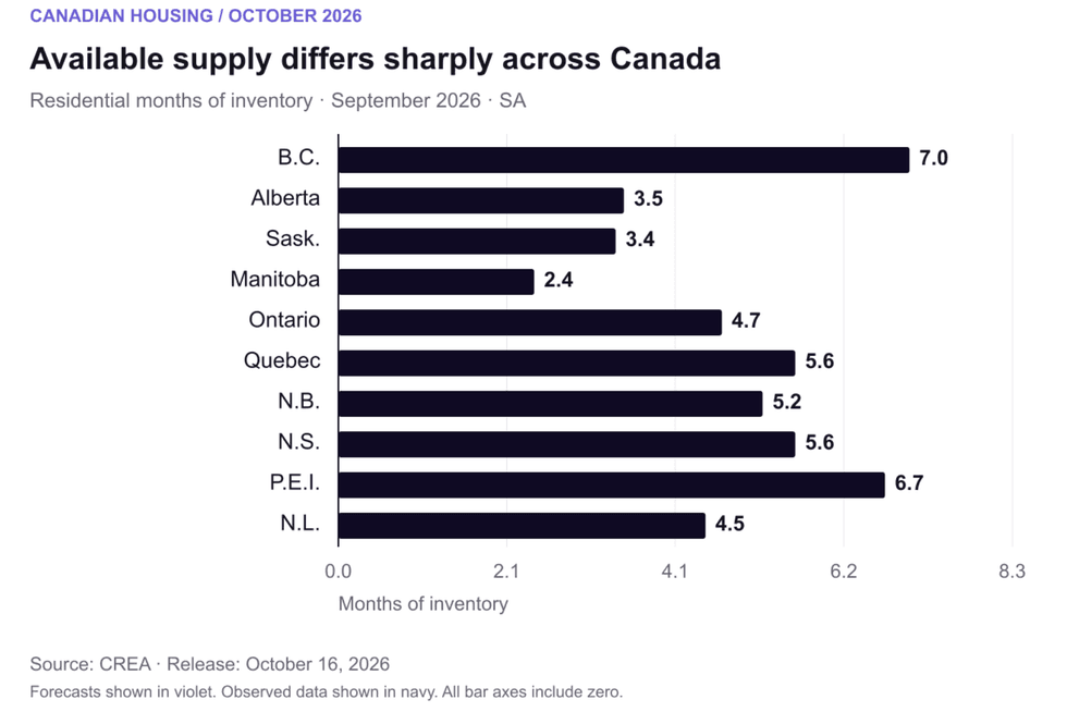 Seasonally adjusted residential months of inventory by province. Local property types can differ substantially. Chart:
 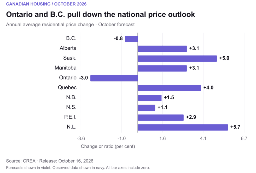 Ontario and B.C. are the two provinces with forecast annual average-price declines in 2026. Chart:
 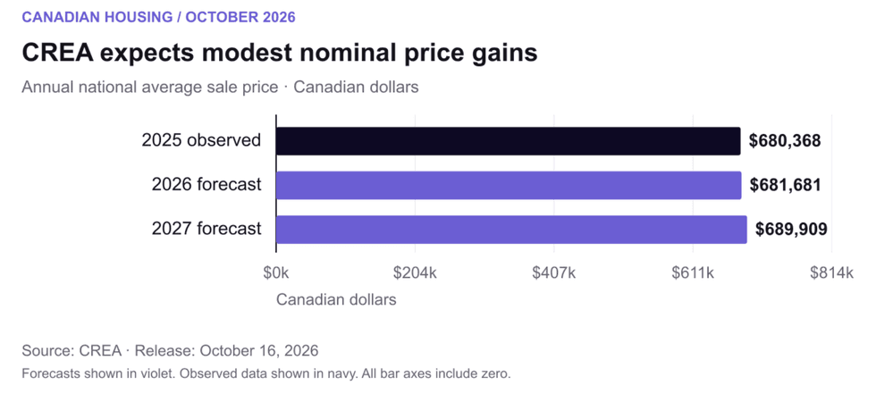 Annual average transaction prices in Canadian dollars. Forecast values are not December price targets. Chart:
 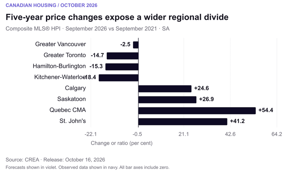 Five-year changes in seasonally adjusted composite MLS® HPI benchmarks, September 2021 to September 2026. Chart: