On Thursday, the City of Surrey released an update on the development of Nicomekl Riverfront Park, including what's been completed, next steps, and rationales the municipality is using to plan and design the park.
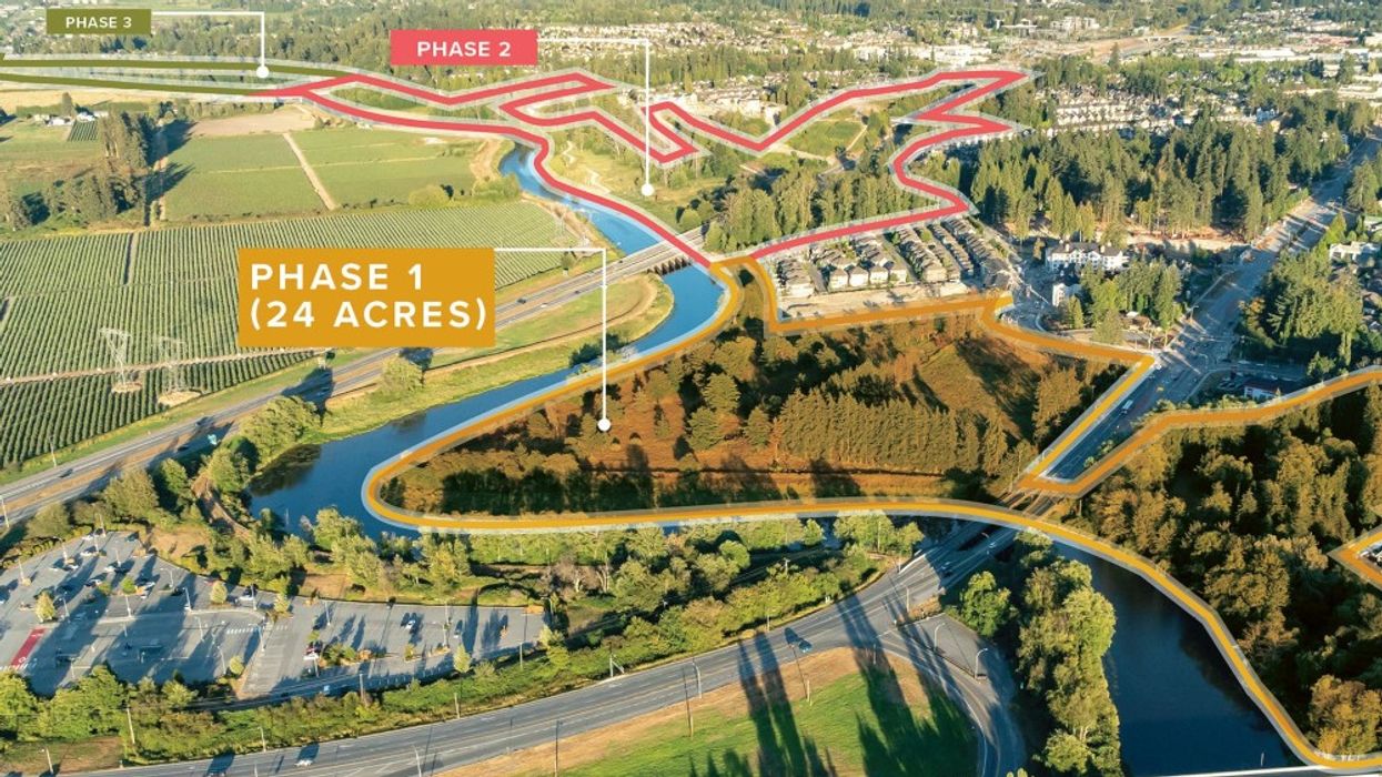
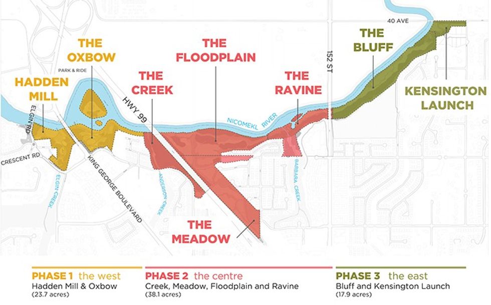
The three-km park will be located along the south side of the Nicomekl River in South Surrey, extending from Elgin Road to 40th Avenue and spanning approximately 80 acres, which is 14 times larger than Surrey's Crescent Beach Park.
The park will be completed in three phases, progressing from west to east, along with Nicomekl River.
Phase One will consist of 23.7 acres and include two large park spaces called Hadden Mill and the Oxbow -- named for the U-shape of the river. Phase Two consists of 38.1 acres between the Anderson Creek and Barbara Creek and will include four park areas: the Creek, the Meadow, the Floodplain, and the Ravine. Phase Three will then consist of 17.9 acres starting from 152 Street going east and include two park spaces called the Bluff and Kensington Launch.
The Nicomekl Riverfront Project is being partially funded by the Government of Canada, through its Disaster Mitigation and Adaptation Fund, a $2B fund distributed across 10 years "to invest in structural and natural infrastructure projects to increase the resilience of communities that are impacted by natural disasters triggered by climate change."
READ: How Climate Change is Affecting Property Insurance, Mortgages, and Buyers
The plans for the park are also part of the City of Surrey Coastal Flood Adaptation Strategy, which was birthed in 2016 to "help Surrey prepare for a changing climate and increase the resilience of its coastal communities." Plans for the park include "making room for the river" to adjust for rising sea levels, while also combining environmental, cultural, heritage, and recreational spaces via a "nature-based design approach will protect flora, fauna, creeks and the park’s natural water system," the City of Surrey says.
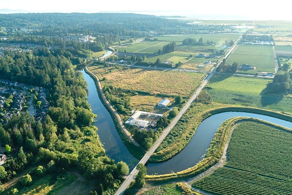
"When complete, the park will provide residents with increased recreational amenities like trails, kayak and canoe launches, a playground and viewpoints," Surrey Mayor Doug McCallum said in project update on Thursday. "It will also protect the environment, support wildlife habitat and help Surrey adapt to climate change and sea level rise."
That update included a list of what the City of Surrey has already done, which includes a ground survey of the site of Phase One and a complete inventory of plant and animal species in the area (there are 654 live trees, 23 non-native plant species, and 29 species of fish in the Nicomekl River). The City has also, among other things, analyzed how wildlife use the area, studied the various water systems in the area (creeks, ponds, ditches), and developed plan drawings to accommodate for their findings.
READ: King George Hub Officially Opens in Surrey, Ushering in New Era
Next steps include consulting with First Nations to learn about the site's history and how to integrate that history, conducting technical design workshops, and securing the necessary permits ahead of construction. A public engagement campaign for the Nicomekl Riverfront Park has also been set for early 2023, ahead of which the City of Surrey says it will release more drawings and renderings.
Phase One is slated to begin construction in 2024 and complete in late 2025. Design on Phase Two will begin in 2024, with construction beginning 2025 and completing in 2026. A timeline for Phase Three has yet to be set.
