Site Plan
Learn what a site plan is in Canadian real estate — why it’s required, what it includes, and how it supports successful project approvals.

July 27, 2025
What is a Site Plan?
A site plan is a detailed drawing that illustrates how a piece of land is intended to be developed or redeveloped, showing building footprints, boundaries, access points, landscaping, utilities, and other relevant features.
Why a Site Plan Matters in Real Estate
In Canadian real estate and construction, site plans are required by municipalities for reviewing and approving new development or significant redevelopment projects.
Key information included in a site plan:
- Property boundaries and lot dimensions
- Building footprints and setbacks
- Parking, walkways, and vehicle access
- Utility connections, grading, and drainage
- Landscaping and outdoor amenities
A complete site plan ensures compliance with zoning, building codes, and urban design standards. It helps stakeholders visualize the project and identify potential issues early in the approval process.
Example of a Site Plan in Action
The architect prepared a site plan detailing proposed building locations and parking layouts to submit with the permit application.
Key Takeaways
- Essential document for development approvals
- Shows site layout, access, and amenities
- Ensures zoning and code compliance
- Helps avoid design and construction conflicts
- Required for most major building projects
Related Terms
- Zoning
- Urban Planning
- Building Permit
- Mixed-Use Development
- Land Use Bylaws


 CBRE Canada
 CBRE Canada

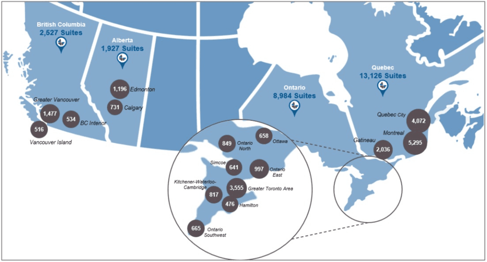 Chartwell’s portfolio as of December 31, 2025. (Chartwell Retirement Residences)

 150 Slater Street in Ottawa. (Regional Group)
 150 Slater Street in Ottawa. (Regional Group)
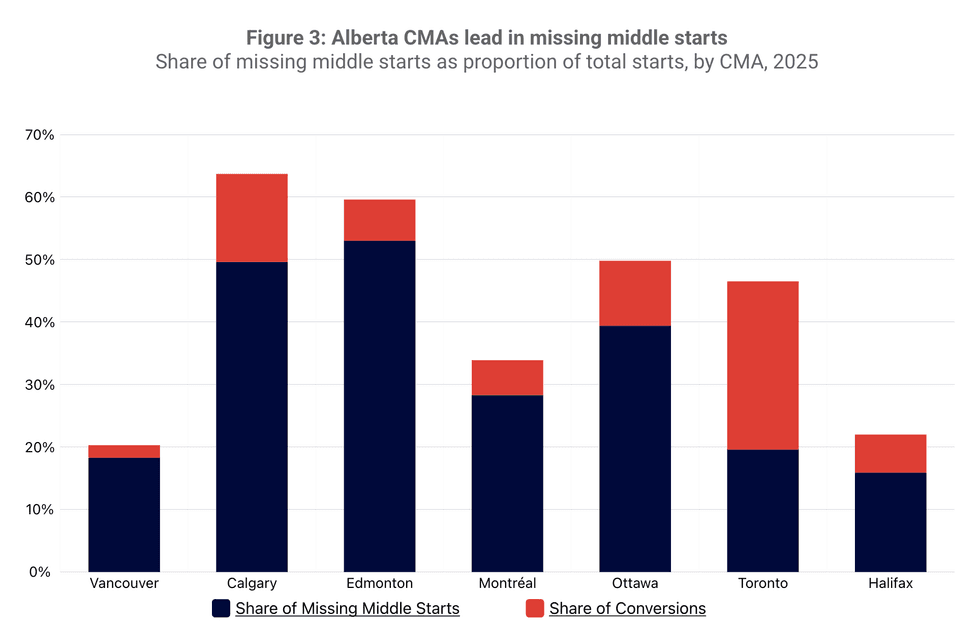 Spring 2026 Housing Supply Report/CMHC
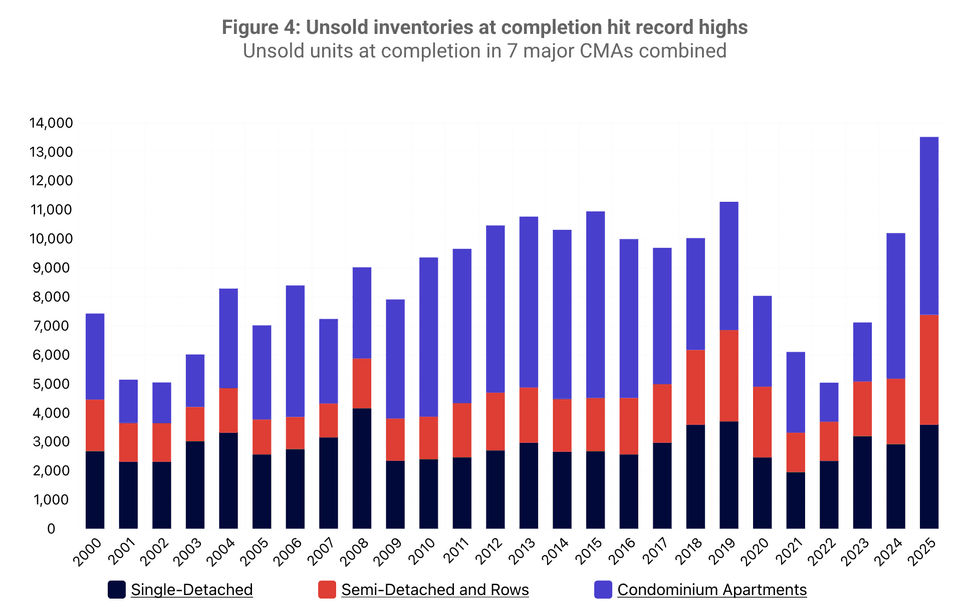 Spring 2026 Housing Supply Report/CMHC