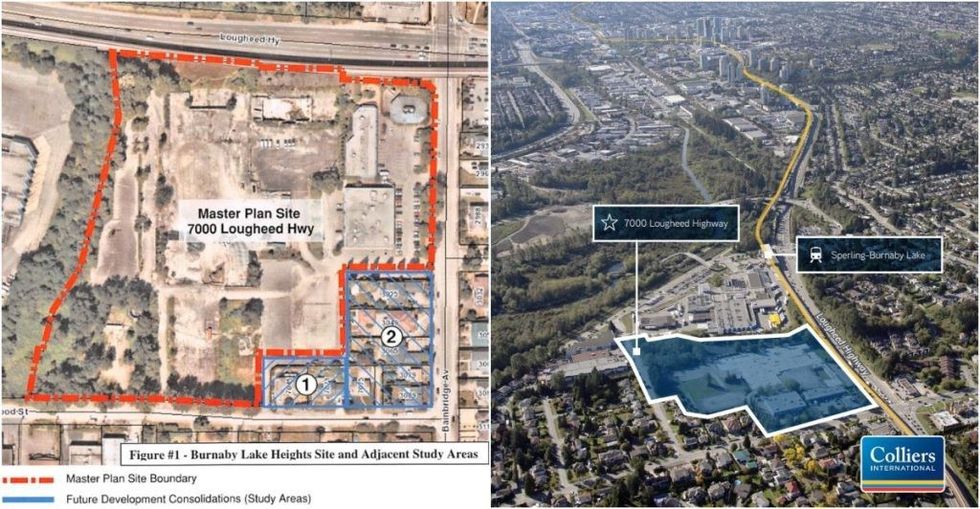
Sperling-Burnaby Lake Station of the Millennium Line SkyTrain is about to become the next development hot spot in the city, as it is now the focus of a new master plan being proposed: Burnaby Lake Heights.
The subject site is 7000 Lougheed Highway, a 14-acre site at the intersection of Lougheed Highway and Bainbridge Avenue, just north of Burnaby Lake and a 10-minute walk east from Burnaby Lake Station.
The site was previously home to an office building owned by Telus Communications, which was demolished in 2015, and was the subject of a lawsuit after Vancouver-based developer Polygon Homes agreed to purchase the site for $175.5M in September 2017, but then backed out of the deal.
The site was then later sold for $151M in late-2021 to another local developer, Create Properties, who submitted their letter of intent and rezoning application to the City of Burnaby in June 2022, and has now submitted a Conceptual Master Plan that Council will likely grant a First Reading to this evening, and then refer to a public hearing.
Burnaby Lake Heights Master Plan
The 7000 Lougheed Highway site is also directly adjacent to a 19-acre site on 6800 Lougheed Highway -- between 7000 Lougheed and Sperling-Burnaby Lake Station -- that is the subject of its own master plan, Burnaby Lake Village. Create Properties is developing that adjacent site along with Vancouver-based Peterson Group, and the two projects are expected to compliment one another, including sharing the same architects -- dys Architecture, Hariri Pontarini Architects, and PWL Partnership Landscape Architects.
The two sites, the City said in report this month, "presents a significant opportunity to create not only transit-oriented development, but a vibrant, distinct, and walkable village centre that is designed around significant public spaces and is complete with diverse land use and building forms that help deliver the necessary housing and local services for the Bainbridge community."
Two "study area" sites -- located at the southeast corner along Bainbridge Avenue and Greenwood Street -- consisting of seven properties have also been included in the plan, although their acquisitions are still pending and are included in the concept plan.
The Conceptual Master Plan is seeking to first establish the "general built form, permitted uses, maximum building heights, signage guidelines, proposed subdivision, and phasing plan" for the overall site. Future rezoning applications for specific sites, after subdivision, will then be guided by this overall plan.
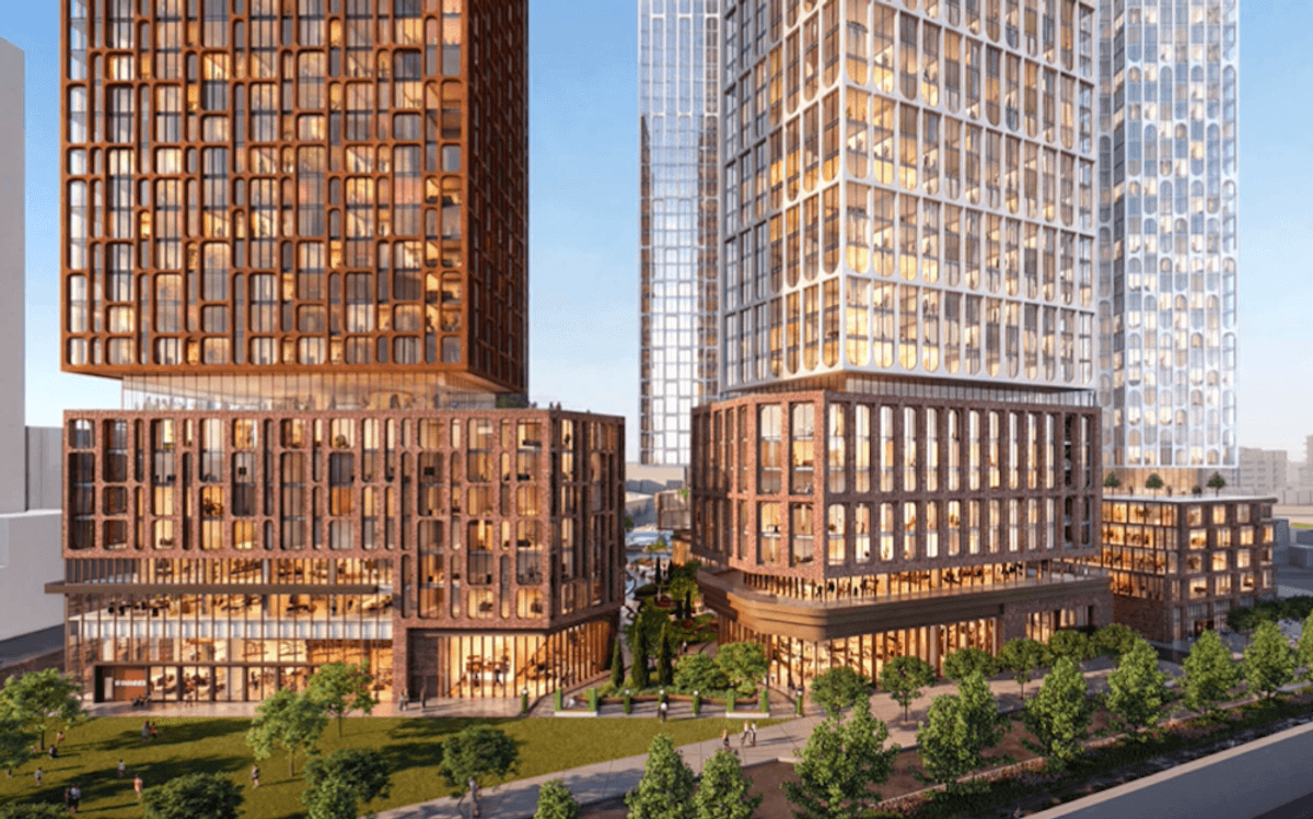
While the final details won't be confirmed until individual rezoning applications are considered, the overall site is envisioned to accommodate up to 12 mixed-used buildings ranging from eight to 16 storeys, with the taller buildings closer towards the centre of the site. The City says that the maximum residential density across the entire site is a floor space ratio (FSR) up to 3.75, while the maximum commercial density permitted would be up to an additional 1.30, for a total of 5.05.
The City says the land use framework Create Properties has proposed incorporates "opportunities for residential strata, non-market and market rental uses, commercial uses including retail, office, medical services, grocery stores, and hospitality uses, as well as the potential for seniors housing and complimentary industrial manufacturing uses."
At the heart of Burnaby Lake Heights would also be a community centre (Building D) that would include childcare space, co-working space, non-profit office space, meeting space, and fitness facilities.
At full build out, the City says, the plan could accommodate upwards of 3,500 units of housing, "catering to a range of household types and income levels, as well as the potential for hundreds of jobs in the retail, hospitality, and knowledge-based industries." (Create Properties' website says more than 2,800 homes.)
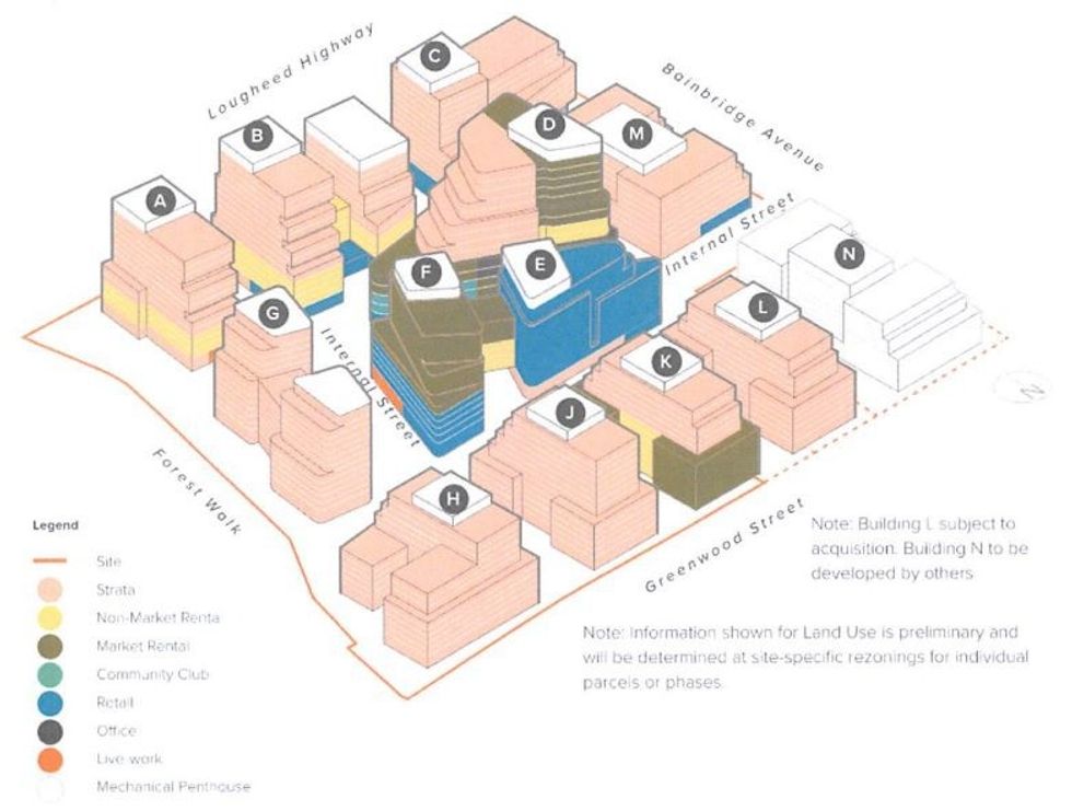 Proposed land use framework for the Burnaby Lake Heights Master Plan. (City of Burnaby / Create Properties)
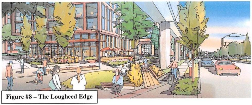
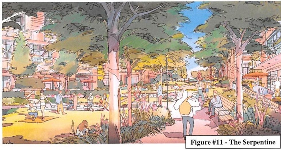
The Burnaby Lake Heights project would add two new streets, an extensive public realm, a new "Forest Walk trail," and a "Serpentine Greenway," as well as include significant upgrades to the existing streets that bound the site.
 The precinct plan (left) and phasing plan (right) for Burnaby Lake Heights. (City of Burnaby / Create Properties)
The overall site would be split into four "precincts," and what's envisioned for each of them, according to the City, are as follows:
Lougheed Precinct (Red):
- "A lively pedestrianized high street lined with restaurants, shopping, amenities, and flexible space for markets and festivals."
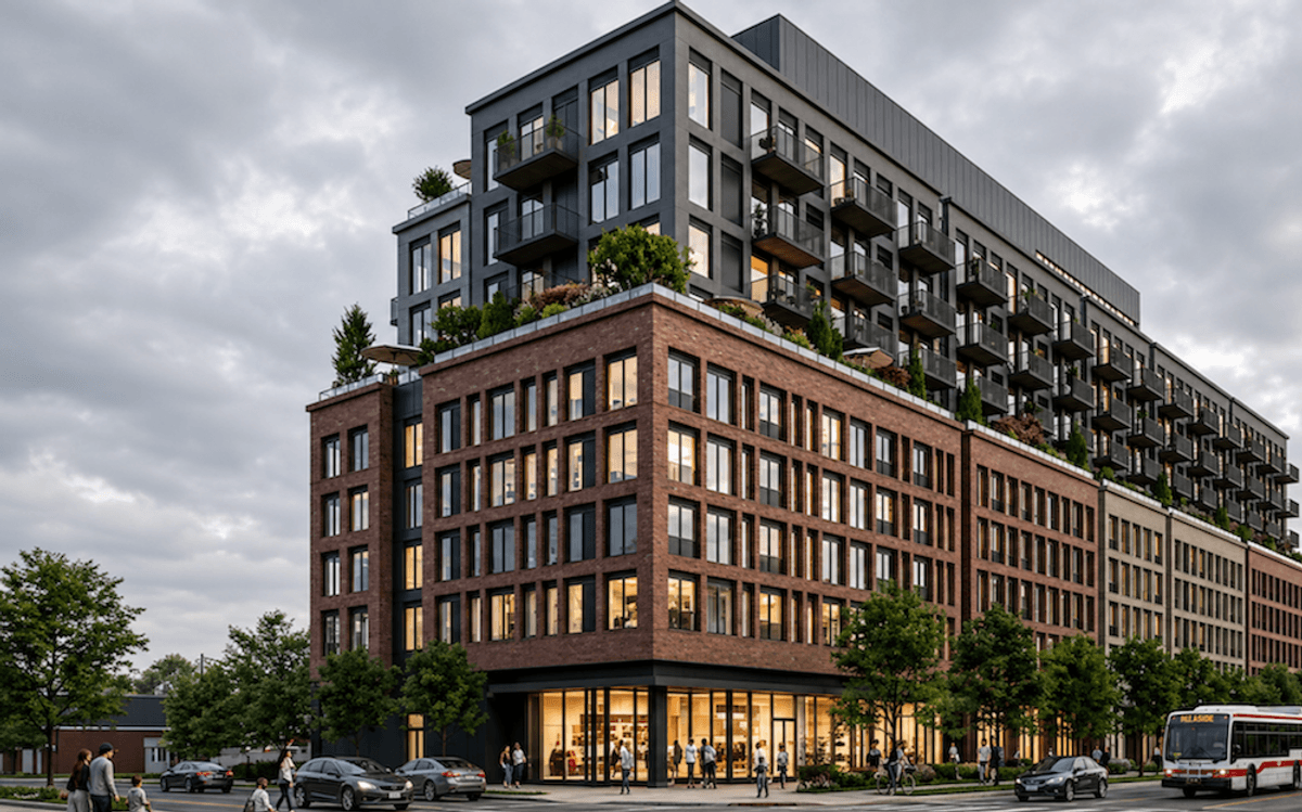
- "The intended form of development would be characterized by three residential buildings between 10 to 16 storeys in height, over a base of retail and office space. This precinct supports the tallest heights on the site, positioned along the Lougheed corridor."
 (City of Burnaby)
Centre Precinct (Yellow):
- "The precinct will provide a critical mass of residential uses within the centre of the site, with its edges helping to activate and contribute to the character of the village's structuring public realm elements."
- "Buildings along the southern and eastern edges of the precinct will be predominantly residential with the potential for locally serving retail along the Serpentine, and some employment and hospitality uses on upper storeys."
 (City of Burnaby)
Bainbridge Precint (Blue):
- "Provides the intended progression in scale and character between the taller buildings to the west, and the lower-density forms of housing to the east, across Bainbridge Avenue."
- "Primarily residential in character, with ground floor commercial uses, including a potential grocery store, and residential uses on upper storeys."
 (City of Burnaby)
Greenwood Precinct (Green):
- "Is intended to deliver a significant share of housing as well as contributing to the realization and completion of the Serpentine and Forest Walk."
- "Will be predominantly residential in character with residential amenity spaces strategically located to anchor and help activate the adjacent green spaces along the Serpentine."
 (City of Burnaby)
The Burnaby Lake Heights Master Plan would be delivered across four phases, although the phases do not align with the precincts, and the City notes that the phasing approach is flexible and could be subject to change, depending on "such factors as vehicular access, parking capacity, timing for community service provisions, and site servicing requirements."
RELATED: Peterson Proposing 14-Tower Master Plan 'Burnaby Lake Village'
According to the City, a public information session was held on February 2, where residents and property owners in or around the area were "generally supportive of the proposals."
"Key recurring comments noted the need for non-market housing, locally scaled retail uses, and access to community services such as medical offices and childcare," according to a City report. "Staff also heard some concerns about the need for a sensitive transition to lower forms of development to the east, and providing sufficient street level activation and surveillance to encourage a safe community throughout all times of the day."
Create Properties has already submitted an individual rezoning application for Phase One of Burnaby Lake Heights, for two mid-rise buildings, but further progression will have to wait until the master plan moves past a public hearing and receives final adoption, which will likely take two months.
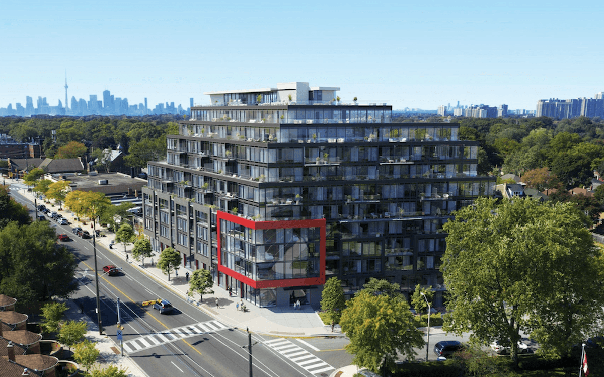
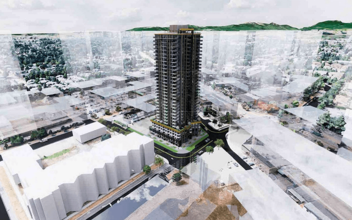
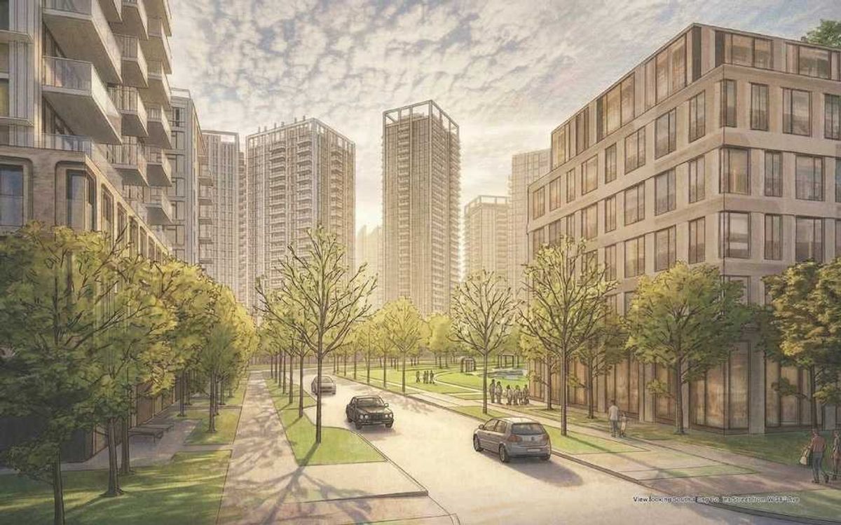
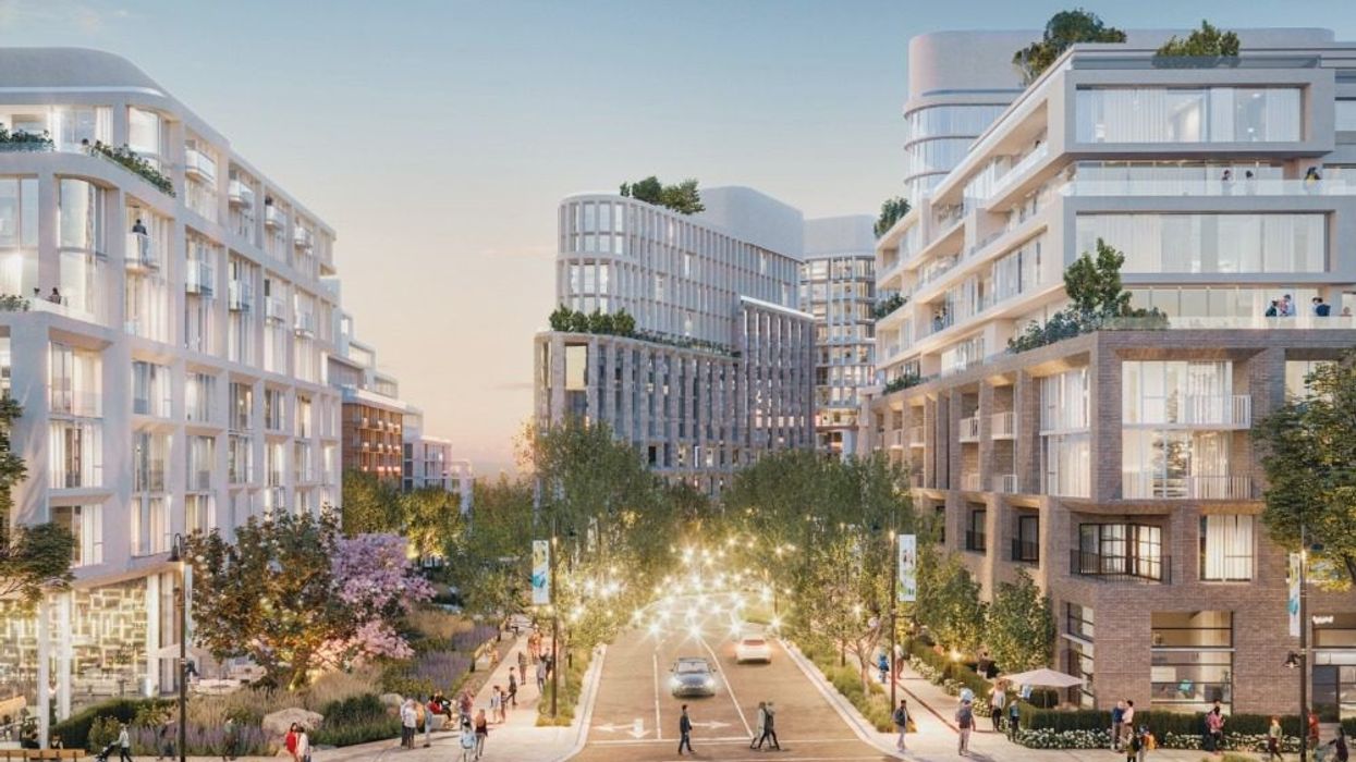
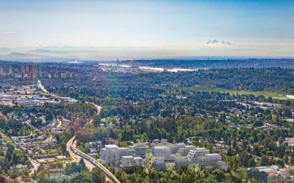 Aerial view of Burnaby Lake Heights at full build out. (Create Properties)