If you feared that our wintry November weather in Toronto and the GTA was the shape of things to come – you’re right.
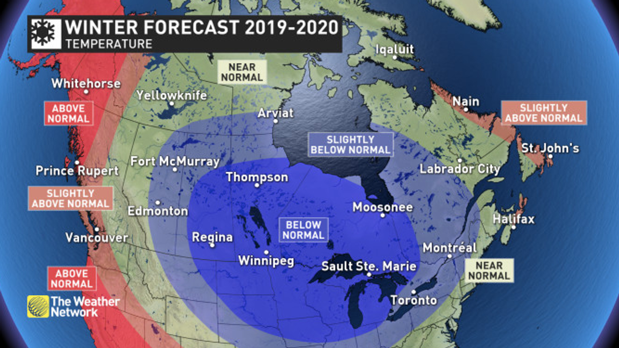
Weather Network meteorologist Dr. Doug Gillham says southern Ontario and indeed much of the country are in for a “classic Canadian” winter.
"Long, cold and snowy."
Forecasters at The Weather Network (TWN) are warning folks in the GTA to expect a severe winter, plus an "active storm track" that will likely bring above normal snow totals to much of southern Ontario.
READ: Here’s What The 2019 Toronto Christmas Market Looks Like
And the news just keeps getting "better".
We're expected to get an abundance of lake-effect snow that is likely to continue until above normal ice coverage on the Great Lakes becomes a limiting factor during February.
The only regions where temperatures are expected to be milder than normal are near the Atlantic and Pacific coastlines.
And what weather awaits us beyond winter?
Great Lake water levels will apparently be a major concern. With current water levels well above normal, a cold and snowy winter across this region could lead to flooding along the shorelines in the spring and into the summer.
READ: This Two-Storey $629,000 Townhouse Offers Fantastic Downtown Living
As for today and the rest of the week, slushy, sloppy wet snow accumulations are expected across southern Ontario today, with temperatures and elevation playing a key role in how much snow piles up and where. Some additional snow is possible for parts of the GTA this week, but, and here's the good news, much milder conditions will help us break out of the recent deep November freeze.
"A system is expected to track into the region at the end of next week, bringing rain and snow," said Gillham, before adding that colder temperature will be back in time for next weekend.
"Near or below seasonal temperatures will dominate the last week of November and into early December."


